[[[SUMMARY_START]]]
Satellite data was built for navigation, weather, mapping and research. It is now also shaping modern conflict.
Commercial images, internet links and location data can reveal troop movements, guide strikes and support battlefield decisions.
That shift is raising legal, security and privacy concerns as governments and companies depend more heavily on space-based services.
[[[SUMMARY_END]]]
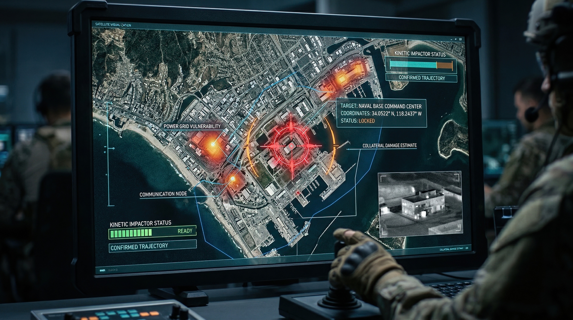
Satellite data has become one of the quiet forces behind modern power. It can show damaged airfields, track ships, map fires, guide drones and keep armies connected when ground networks fail.
What changed is not only the technology, but the users. Governments once dominated military space systems. Now private companies sell high-resolution images, communications links and analytic tools that can quickly move from civilian uses to military ones. In wartime, that can turn a data service into a strategic asset and, in some cases, a target.
In Ukraine, commercial satellite imagery and satellite internet showed how powerful that shift can be. Images from private firms helped expose military buildups before the full-scale invasion in 2022. During the war, the same kind of imagery has been used to monitor troop movements, assess damage and support military planning. Satellite internet systems also helped maintain communications when other networks were damaged or unavailable.
That has blurred the line between civilian and military infrastructure. A company may market imagery for agriculture, shipping or insurance. But the same data can identify bridges, fuel depots or aircraft on a runway. A communications network built for remote homes can also help connect units in combat.
## A civilian service with military value
This dual-use problem is now central to space security. Commercial systems can add speed, volume and flexibility that governments alone cannot easily match. They can produce frequent images, move data fast and serve many users at once.
That makes them useful in war. It also makes them vulnerable.
Russian officials have previously warned that commercial satellites used for military purposes could become legitimate targets. That warning captured a wider reality: once private space services directly support military action, they may be seen by adversaries as part of the battlefield.
The risk is not limited to physical attack. Much of today’s pressure happens through jamming, spoofing, cyberattacks and signal interference. These methods can disrupt service without creating the debris that would follow a missile strike in orbit. They are less dramatic, but often more practical.
The concern is growing because many military and civilian systems now depend on the same space-based backbone. A disruption aimed at one user can spill over to many others. Farmers, airlines, cargo fleets, emergency responders and aid groups may rely on the same positioning, communications or imaging services that armed forces use.
## Open images, closed consequences
Another change is the spread of open-source intelligence. Analysts, activists and journalists can now use commercial satellite images to track air bases, naval deployments, damaged buildings and mass displacement. This has increased public visibility during war. It has also made secrecy harder.
As image quality improves and revisit times become shorter, that value rises. Recent policy analysis has warned that wider access to earth observation data, especially when paired with artificial intelligence, is creating new concerns around national security, privacy and trust. There are also worries about spoofing and manipulated signals, which could distort decision-making in a crisis.
This means the weapon is not always the satellite itself. Sometimes it is the timing of the data, the combination of datasets, or the algorithm that turns raw imagery into a target list, movement forecast or threat alert.
## Rules lag behind technology
International law has not fully caught up with this shift. The 1967 Outer Space Treaty bans weapons of mass destruction in orbit, but it does not offer a full answer to today’s questions about commercial data, cyber interference, signal denial and dual-use constellations.
There are broader legal principles for armed conflict, including rules on distinction and proportionality. But applying them to commercial satellite services is difficult. A single network may serve hospitals, news organizations, shipping firms and armed forces at the same time. That makes any decision to disrupt or attack it highly consequential.
Governments are also still debating how much control they should have over private satellite operators during crises. Some want tighter national rules for data access, licensing and emergency shutdown powers. Others fear that heavy restrictions could undermine the openness that has made commercial space services so valuable.
## A strategic layer of everyday life
The deeper issue is that satellite data now sits inside daily life as well as national defense. It helps route cargo, forecast storms, guide tractors, support rescue work and connect remote communities. That same infrastructure can be drawn into conflict with little warning.
When satellite data becomes a weapon, the change is often subtle at first. A map becomes targeting support. A broadband link becomes military command connectivity. A picture from orbit becomes evidence, intelligence or both.
That is why the debate is expanding beyond space agencies and defense ministries. It now touches regulators, technology companies, humanitarian groups and ordinary users who may not realize how much depends on systems far above the Earth.
AI Perspective
Satellite data is becoming harder to classify as purely civilian or purely military. That matters because modern societies rely on the same space services for both daily life and national security. The challenge ahead is to keep the benefits of open access and innovation without making essential infrastructure easier to exploit or attack.


-134c72da.webp)


-6c40e5ef.webp)